
UPDATE: As of November 2024, This Crazy Adventure Called Life blog has been "retired." While you will still find some of the tips on the site helpful, please know that articles are not updated with current information.
As always, you can get the best deals on Theme Park vacations, cruises and more through my partners at Get Away Today.
We may earn money or products from the companies mentioned in this post.
As a state blessed with an extensive coastline, Oregon offers an array of hiking trails that boast mesmerizing views of the Pacific Ocean. Whether you are a seasoned hiker or a beginner, the Oregon Coast has something for everyone. From rocky shorelines to lush green forests, here are some of the best Oregon Coast hikes that you won’t want to miss.
1. Cape Lookout Trail: Oregon Coast Hike
Located in Tillamook County, Cape Lookout is one of the most popular hikes on the Oregon Coast. The trail offers a scenic, five-mile round-trip hike that will take you through old-growth forests and along the rocky coastline.
The highlight of the trail is the stunning view of the ocean from the top of Cape Lookout.
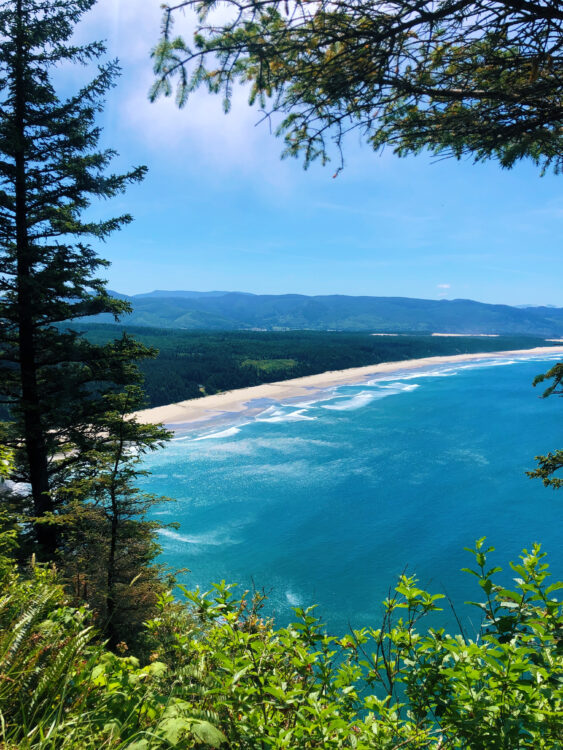
The hike begins at the Cape Lookout Trailhead, where you will start on a gradual uphill path through the forest. After about a mile, the trail opens up to a cliffside view of the ocean.
The trail then continues along the cliffs, providing breathtaking views of the ocean and the coastline. As you reach the end of the trail, you will be rewarded with a panoramic view of the ocean from the top of Cape Lookout.
Hike Quick Facts: Cape Lookout Trail On The Oregon Coast
- Elevation Gain: 793 feet
- Difficulty Level: Moderate – Hard
- Distance: 5 miles out-and-back
- Time to Hike: 3 – 5 hours
2. Neahkahnie Mountain Trail Via South Trailhead: Oregon Coast Hikes
Located in Oswald West State Park, the Neahkahnie Mountain Trail offers a challenging three-mile round trip hike that rewards hikers with stunning views of the Pacific Ocean. The trail is steep and strenuous but is well worth the effort for the incredible vistas from the top.

The trailhead is located just off Highway 101, and the hike starts with a steep incline through dense forest. As you climb, you will start to catch glimpses of the ocean through the trees.
Eventually, the trail will open up, and you will be treated to sweeping views of the coastline. At the top of Neahkahnie Mountain, you will have a panoramic view of the ocean and the surrounding mountains.
Neahkahnie Mountain Trail Quick Facts – Via South Trailhead
- Elevation Gain: 885 feet
- Difficulty Level: Moderate – Hard
- Distance: 3 miles round trip
- Time to Hike: 1.5 – 2 hours round trip
3. Samuel H. Boardman State Scenic Corridor
The Samuel H. Boardman State Scenic Corridor is a 12-mile stretch of coastline located in Curry County. The corridor boasts numerous trails that offer stunning views of the ocean and the surrounding forests. There are many trails to choose from, so it’s worth spending a day or two exploring the area.
One of the most popular trails is the Arch Rock View Trail, which is a short and easy hike that takes you to a natural arch in the rock. Another popular hike is the Secret Beach Trail, which is a bit more challenging but rewards hikers with stunning views of the ocean and a secluded beach.
Quick Facts For Arch Rock View Trail: Oregon Coast Hike
- Elevation gain: Approx. 22 feet
- Difficulty level: Easy (paved trail)
- Distance round trip: .5 miles
- Time to hike: About 20-30 minutes

Secret Beach trail Facts: Oregon Coast Hikes
- Elevation gain: 374 feet
- Difficulty level: Moderate
- Distance round trip: 1.6 miles round trip
- Time to hike: 1 hour
4. Ecola State Park
Ecola State Park is located just north of Cannon Beach and offers a variety of hiking trails that showcase the beauty of the Oregon Coast. The park’s trails range from easy strolls along the beach to more challenging hikes through dense forests.
One of the most popular hikes in the park is the Clatsop Loop Trail, which is a moderate three-mile loop hike that takes you through dense forest and along the coastline. The trail offers stunning views of the ocean and the surrounding mountains.

Another popular hike is the Indian Beach Trail, which is a short and easy hike that takes you to a secluded beach.
Quick Facts About Clatsop Loop Trail:
- Elevation gain: 784 feet
- Difficulty: Moderate
- Distance: 2.8-mile loop
- Time to hike: 1.5 – 2 hours
Facts for Indian Beach Trail: Oregon Coast Hikes
- Elevation gain: 843 feet
- Difficulty: Moderate
- Distance round trip: 3.8 mile
- Time to hike: 2 – 3 hours
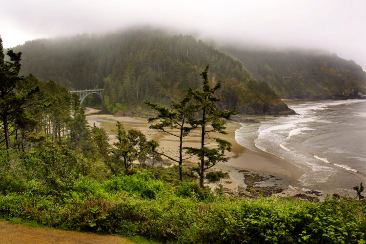
5. Heceta Head Lighthouse Trail – My favorite Oregon Coast Hike for families
The Heceta Head Lighthouse Trail is a short but stunning hike located in Lane County. The trail is only a mile round trip but offers breathtaking views of the ocean and the Heceta Head Lighthouse. This is one of many Oregon Coast Lighthouses, but it happens to be my favorite.
The trailhead is located just off Highway 101, the hike begins with a gradual uphill climb through dense forest. As you reach the top of the hill, the trail opens up to a panoramic view of the ocean and the lighthouse.
This is one of my favorite hikes on the Oregon Coast, and I have done it many times. It is a great addition to a family vacation in Newport, Oregon, as well as close enough to add to a Florence, Oregon trip.
There is a gift shop located 2/3 of the way up the trail.
Quick Facts Heceta Head Lighthouse Trail
- Elevation gain: Approximately 500 feet.
- Difficulty level: Easy – Moderate
- Distance: .9 miles round trip
- Time to hike: About 45 minutes round trip, depending on your pace
6. Lower Cascade Head Trail
The Lower Cascade Head Trail is located in Lincoln County and offers hikers a challenging four-mile round-trip hike that leads to stunning views of the Oregon Coast. The trail is steep and rocky, but the reward at the end is well worth the effort.
The trailhead is located just off Highway 101, and the hike begins with a steep climb through dense forest.
As you gain elevation, you will start to catch glimpses of the ocean through the trees.
Eventually, the trail will open up to a breathtaking view of the coastline. On a clear day, you can see all the way to Tillamook Head to the north and Cape Foulweather to the south.
Hike Quick Facts For Lower Cascade Head Trail
- Elevation gain: Approximately 1100 feet.
- Difficulty level: Moderate – Hard
- Distance: 4.2 miles round trip
- Time to hike: About 3 hours round trip, depending on your pace
7. Hobbit Trail
The Hobbit Trail is located in Lane County and is a short and easy-moderate hike that takes you through dense forest to a secluded beach.
The trail gets its name from the lush green vegetation and towering trees that make it feel like you’re walking through a magical forest.
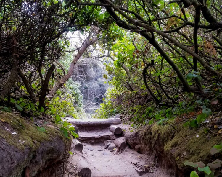
The trailhead is located just off Highway 101, and the hike begins with a short walk through the forest. As you reach the end of the trail, you will be rewarded with stunning views of the ocean and a secluded beach that’s perfect for a picnic.
While this is always listed as an “easy hike” on trail sites, I have marked it as easy to moderate as the climb back up can be quite steep for some. There are also natural stairs on the path (made from dirt and roots) that are quite high. My mother-in-law (4’8″) was too short to be able to go up them and had to go off-trail to get back up the hill.
Oregon Coast Hike Quick Facts: Hobbit Trail
- Elevation gain: Approximately 375 feet.
- Difficulty level: Easy – Moderate
- Distance: 1.1 miles round trip
- Time to hike: About 45 minutes round trip, depending on your pace
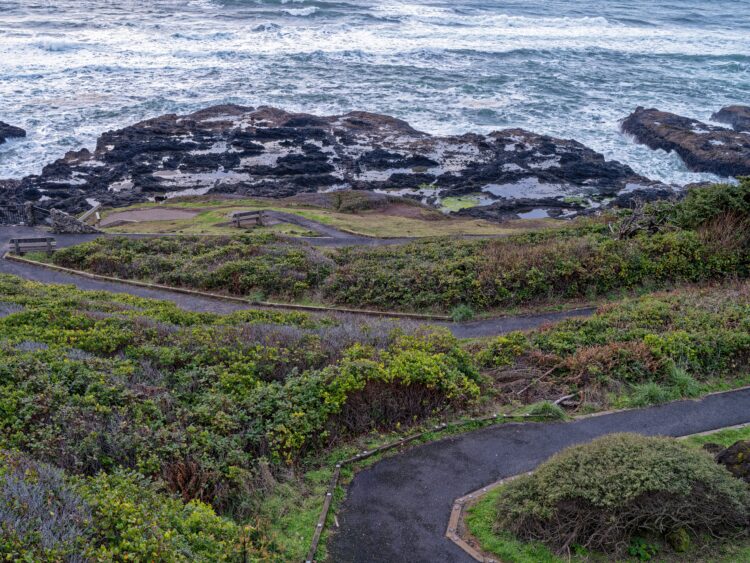
8. Devil’s Punchbowl State Natural Area
The Devil’s Punchbowl State Natural Area is located in Lincoln County and is known for its unique geological formations and stunning views of the ocean. There are several trails in the area that offer different views of the coastline and the Punchbowl itself.
One of the most popular trails is the Devil’s Punchbowl Trail, which is a short and easy hike that takes you to the edge of the Punchbowl.
The trail offers stunning views of the ocean and unique rock formations.
This trail is listed as being wheelchair friendly.
Quick Facts About Devil’s Punchbowl Trail
- Elevation gain: Approximately 50 feet.
- Difficulty level: Easy
- Distance: .7 miles round trip
- Time to hike: About 20 minutes round trip, depending on your pace
9. Cape Perpetua Scenic Area
The Cape Perpetua Scenic Area is located in Lane County and offers a variety of hiking trails that showcase the beauty of the Oregon Coast. The area boasts dense forests, rocky shorelines, and stunning views of the ocean.
One of the most popular trails is the Captain Cook Trail, which is a short and easy hike that takes you to the top of Cape Perpetua. The trail offers panoramic views of the coastline and the surrounding mountains.
Another popular trail is the Giant Spruce Trail, which is a bit more challenging but takes you through a dense forest to a towering spruce tree.
Hike Facts: Captain Cook Trail On Oregon Coast
- Elevation gain: Approximately 98 feet.
- Difficulty level: Easy
- Distance: .6 miles round trip
- Time to hike: About 25 minutes round trip, depending on your pace
Hike Quick Facts Giant Spruce Trail
- Elevation gain: Approximately 236 feet.
- Difficulty level: Easy – Moderate
- Distance: 1.9 miles round trip
- Time to hike: About 45 minutes round trip, depending on your pace
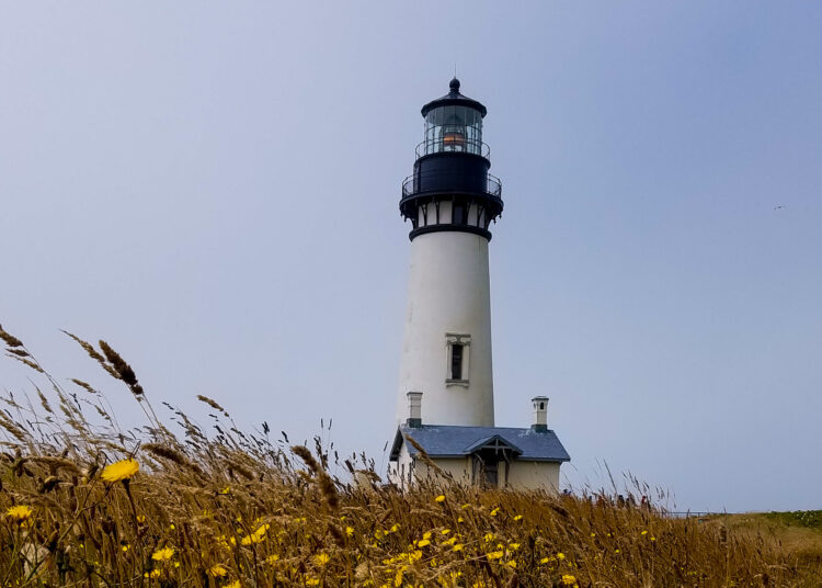
10. Yaquina Head Outstanding Natural Area
The Yaquina Head Outstanding Natural Area is located in Lincoln County and is known for its stunning views of the ocean and the Yaquina Head Lighthouse. The area boasts several hiking trails that offer different views of the coastline and the lighthouse.
One of the most popular trails is the Yaquina Head Trail, which is a short and easy hike that takes you to a viewpoint overlooking the ocean and the lighthouse. The trail also passes by the historic Yaquina Head Lighthouse. This trail is wheelchair friendly.
Another popular trail is the Cobble Beach Trail, which is a bit more challenging, as it is basically stairs taking you down closer to the water, but rewards hikers with stunning views of the ocean and a secluded beach.
Quick Facts Yaquina Head Lighthouse Trail
- Elevation gain: Approximately 6 feet.
- Difficulty level: Easy
- Distance: .4 miles round trip
- Time to hike: About 10 minutes round trip, depending on your pace
11. Oswald West State Park
Oswald West State Park is located in Tillamook County and offers a variety of hiking trails that showcase the beauty of the Oregon Coast. The park boasts dense forests, rocky shorelines, and stunning views of the ocean.
One of the most popular trails is the Short Sands Beach Trail, which is a short and easy hike that takes you to a secluded beach that’s popular with surfers. The trail passes through dense forest and over a suspension bridge.
Oregon Coast Hike Facts: Short Sands Beach Trail
- Elevation gain: Approximately 82 feet.
- Difficulty level: Easy
- Distance: 1.2 miles round trip
- Time to hike: About 30 minutes round trip, depending on your pace